| This website is "one woman's opinion" on Atlin, the community I love. Discover Atlin is paid for and maintained by me. I started it in 2004. All the editorial comments are mine and can be blamed solely on me. All photos are mine unless stated otherwise. Feel free to use my photos if you give the following photo credit ©Carolyn Moore, Atlin BC Canada. Photos by others may not be used without their permission. Carolyn Moore |
MAPS
Atlin is the most beautiful place on Earth; in any season, in any weather.
|
|
Travelogue for Highway 7 & Warm Bay Road See this travelogue to plan your stay in Atlin. It takes you from Jake's Corner to Atlin, a distance of about 98 km; then south on Warm Bay Road to the Warm Springs and the Grotto, a distance of about 27 km.
This site has the best map of the Southern Lakes area: the communities of Atlin, Carcross, Marsh Lake, Mount Lorne, Tagish, and Teslin.
|
|
|
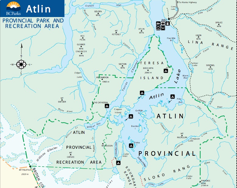
For further information about Atlin, contact Atlin Visitors Association at 250-651-7522. http://atlinvisitors.net/Map below is from BC Provincial Parks |

 |